


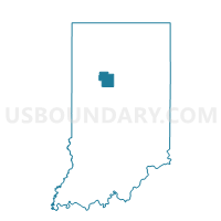
MADISON, Carroll County, Indiana
About
Outline

Summary
| Unique Area Identifier | 576525 |
| Name | MADISON |
| County | Carroll County |
| State | Indiana |
| Area (square miles) | 20.87 |
| Land Area (square miles) | 20.87 |
| Water Area (square miles) | 0.00 |
| % of Land Area | 100.00 |
| % of Water Area | 0.00 |
| Latitude of the Internal Point | 40.50741370 |
| Longtitude of the Internal Point | -86.63846280 |
Maps


Graphs
Select a template below for downloading or customizing gragh for MADISON, Carroll County, Indiana


Neighbors
Neighoring Voting District (by Name) Neighboring Voting District on the Map
- CLAY, Carroll County, IN
- DEER CREEK I, Carroll County, IN
- DEMOCRAT, Carroll County, IN
- MONROE I, Carroll County, IN
- WASHINGTON 01, Tippecanoe County, IN
Top 10 Neighboring County Subdivision (by Population) Neighboring County Subdivision on the Map
- Deer Creek township, Carroll County, IN (4,571)
- Monroe township, Carroll County, IN (2,797)
- Washington township, Tippecanoe County, IN (2,432)
- Clay township, Carroll County, IN (1,255)
- Democrat township, Carroll County, IN (885)
- Madison township, Carroll County, IN (433)
Top 10 Neighboring Unified School District (by Population) Neighboring Unified School District on the Map
- Tippecanoe School Corporation, IN (89,548)
- Delphi Community School Corporation, IN (9,651)
- Carroll Consolidated School Corporation, IN (6,571)
- Rossville Consolidated School District, IN (5,083)